
DOI: https://doi.org/10.34069/AI/2025.86.02.21
Volume 14 - Issue 86: 281-297 / February-december, 2025
How to Cite:
Sunko, T., Dedo, M., Popović, R., Mišković, T., Delić, M., & Strnad, L. (2025). The role of geographical and legal features in optimizing security and control of semi-enclosed seas: A case study of the eastern Adriatic Sea. Amazonia Investiga, 14(86), 281-297. https://doi.org/10.34069/AI/2025.86.02.21
The role of geographical and legal features in optimizing security and control of semi-enclosed seas: A case study of the eastern Adriatic Sea
Uloga geografskih i pravnih obilježja poluzatvorenih mora u optimizaciji sigurnosti i nadzora: studija slučaja istočnog Jadranskog mora
Received: September 30, 2025 Accepted: November 20, 2025
Written by:
Tomislav Sunko
https://orcid.org/0000-0002-9287-5642
PhD., Asst. Prof., Ministry of Defence of the Republic of Croatia, Croatian Defense Academy “Dr Franjo Tuđman”, Zagreb, Croatia. Email: tsunko@morh.hr
Mihael Dedo
https://orcid.org/0000-0002-5968-3171
University Magister of Engineering in Naval/Maritime Traffic, Ministry of Defence of the Republic of Croatia, Croatian Defense Academy “Dr Franjo Tuđman”, Zagreb, Croatia. Email: mihael.dedo@morh.hr
Ružica Popović
https://orcid.org/0009-0004-5989-8676
PhD., Croatian Meteorological and Hydrological Service, Regional Meteorological Office Split, Split, Croatia. Email: r.popovicstzg@gmail.com
Toni Mišković
https://orcid.org/0000-0002-5032-034X
Master of Engineering in Electrical Engineering, Transmitters and Communications Ltd., Zagreb, Croatia. Email: toni.miskovic@oiv.hr
Marin Delić
https://orcid.org/0009-0009-9575-270X
Bachelor of Engineering in Nautical Studies / Nautical Science, Split Ship Management, Split, Croatia. Email: deliae_0212@hotmail.com
Lovro Strnad
https://orcid.org/0009-0005-0478-875X
Student, Rectory, Dr. Franjo Tuđman Defense and Security University, Zagreb, Croatia. Email: lovro.strnad@student.sois-ft.hr
Abstract
Semi-enclosed seas are geographic areas specifically defined by their general geometry. Geographical characteristics heavily influence the possibilities and challenges of surveillance, security and navigation of semi-enclosed seas. This paper analyses specifications and typical challenges that occur within the semi-enclosed seas, firstly by defining them and secondly by comparing different challenges that occur within different geographical areas. The causality of typical challenges is then correlated to geomorphological, geopolitical and hydrometeorological properties of semi-enclosed seas. Heavy focus is on the problematics arising on the eastern coast of Adriatic. These are further compared to the general properties of challenges occurring in the semi-enclosed seas analysed by comparison of different regions, resulting in not only a correlation between semi-enclosed sea properties, but also a clear systematizations and categorization of those problems which will enable further research on combating them.
Keywords: Semi-enclosed sea, security, surveillance, Adriatic.
Sažetak
Poluzatvorena mora su geografska područja posebno definirana svojom općom geometrijom. Geografske značajke snažno utječu na mogućnosti i izazove nadzora, sigurnosti i navigacije u poluzatvorenim morima. Ovaj rad analizira specifičnosti i tipične izazove koji se javljaju u poluzatvorenim morima, prvenstveno njihovom definicijom, a zatim usporedbom različitih izazova koji nastaju u različitim poluzatvorenim morima. Uzroci tipičnih izazova potom se povezuju s geomorfološkim, geopolitičkim i hidrometeorološkim svojstvima poluzatvorenih mora. Poseban naglasak stavljen je na problematiku koja nastaje na istočnoj obali Jadrana. Ona se dalje uspoređuje s općim obilježjima izazova prisutnih u poluzatvorenim morima analiziranim usporednim prikazom različitih regija, što rezultira ne samo utvrđivanjem povezanosti između svojstava poluzatvorenih mora i samih problema, već i jasnom sistematizacijom i kategorizacijom tih problema koja će omogućiti daljnja istraživanja u svrhu prevladavanja istih.
Ključne riječi: Poluzatvoreno more, sigurnost, nadzor, Jadran.
Introduction
The precondition for achieving a higher level of maritime security for coastal states with access to semi-enclosed seas is the effective implementation of sea control and protection to reduce threats and risks at sea. The analysis of the maritime situation is defined as a process, an examination of the situation, its elements and their relationships. Early detection and neutralization of threats posed by vessels is one of the key tasks of coastal state services in the context of control and protection of maritime traffic, as well as critical infrastructure.
For the purpose of maritime security, control and protection systems are organized depending on: the sea surface area, geostrategic position, and meteorological-oceanographic conditions of the coast and islands. Given the demanding task of maritime traffic surveillance and control of the state border at sea, the spatial features of semi-enclosed seas have been defined and analysed with the goal of improving the effectiveness of existing management models and future deployment of resources by state administration bodies.
First section of this paper provides a detailed analysis of the features and properties of semi-enclosed seas, with focus on Adriatic. Furthermore, analytical comparison of different challenges of various semi-enclosed seas worldwide helps to correlate specific challenges to specific properties and provide a systematic overview linking typical causes to typical problems.
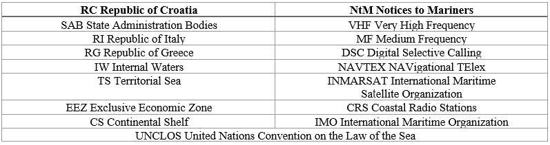
Second section analyses how the nature of semi-enclosed seas influences navigation and surveillance on the Adriatic. Moreover, an analysis of the common problems of eastern Adriatic is compared and categorized within the systematic framework that was presented in the first section, further strengthening the systematic framework as well as providing additional information and findings that might in future help to find easier ways to combat said challenges. All abbreviations used in the preparation of this paper are listed in the nomenclature table.
Table 1.
Nomenclature
Methodology
This paper adopts a qualitative and comparative case-study approach to examine the challenges of maritime surveillance along the eastern Adriatic coast. The methodological choice stems from the recognition that surveillance difficulties on eastern Adriatic arise not from a single variable but from the interplay of geomorphology, hydrometeorology, legal frameworks, and institutional structures. Rather than seeking quantifiable performance measures of technical systems, the study employs interpretive analysis to identify recurring patterns and categories of constraints.
The primary unit of analysis is the eastern Adriatic, understood as a part of a semi-enclosed sea system under the definition of the UNCLOS. Within this framework, the paper investigates both the legal-institutional context (border disputes, maritime spatial planning, institutional fragmentation) and the technical-environmental context (impacts of geomorphology and hydrometeorology on surveillance).
A comparative method is applied by situating Croatia’s challenges within the broader category of semi-enclosed and indented seas. Comparative references include the Baltic, the Aegean, and selected chokepoints such as the Strait of Hormuz and Bab el-Mandeb. These examples are not used to provide exhaustive regional surveys, but to highlight the structural similarities that arise when semi-enclosed geography and fragmented governance intersect.
Finally, the limitations of the methodology must be acknowledged. The analysis is based on open-source academic and legal material; classified technical or operational naval data are not included. The findings therefore remain conceptual and structural in nature, oriented toward understanding patterns rather than evaluating the performance of specific systems.
Literature review
The materials for this study consist of legal documents, academic literature, and applied case studies.
At the international level, UNCLOS provides the legal definition of semi-enclosed seas, as well as principles relevant to cooperation and surveillance. European Union frameworks on maritime spatial planning further inform the legal-institutional context, establishing requirements for coherence and integration across member states.
At the national level, Croatian legislation and policy documents relating to maritime spatial planning, concessions, and jurisdiction form a crucial material basis. Scholarly work has emphasized the persistence of institutional fragmentation and the underdevelopment of GIS infrastructure in eastern Adriatic maritime governance. While regional GIS applications exist, the absence of a comprehensive national framework reduces integration and limits cross-sectoral coordination.
The geomorphological features of the Adriatic are a further focus of the literature. The eastern Adriatic is characterized by its highly indented coast and large number of islands and islets, creating permanent challenges for surveillance and monitoring. This geomorphology complicates not only technical coverage but also legal clarity, as shown in dispute over Piran Bay, which underscores how natural coastal configurations intersect with questions of sovereignty.
The hydrometeorological literature provides critical insights into the Bora and Sirocco winds, which directly affect maritime operations. The Bora, a cold and gusty wind from the northeast, introduces instability and operational risk, while the Sirocco, a moist southeasterly wind linked to cyclonic activity, produces reduced visibility and hazardous sea states. Both winds have been shown to degrade the reliability of radar and optical surveillance, introducing environmental uncertainty into an already complex geomorphological setting.
Comparative material includes research on other semi-enclosed and indented seas. The Baltic and Aegean Seas illustrate how geographic constraints and overlapping jurisdictions complicate surveillance, while the Strait of Hormuz exemplifies a chokepoint where geomorphology and geopolitics converge. These cases are used as analytical mirrors to situate the Adriatic, underscoring both the commonalities and the distinctiveness of Croatia’s maritime challenges.
Together, these materials constitute a layered foundation for the analysis. Legal sources define the framework of governance, technical and environmental studies reveal the natural constraints, Adriatic-focused literature provides regional specificity, and comparative cases situate the Croatian experience within a wider category of maritime surveillance environments.
The concept and features of semi-enclosed seas
According to the United Nations Convention on the Law of the Sea, "...a closed or semi-enclosed sea means a gulf, basin or sea surrounded by two or more States and connected to another sea or ocean by a narrow outlet or consisting wholly or primarily of the territorial seas and exclusive economic zones of two or more coastal States." (UNCLOS, 1982).
Coastal states bordering a closed or semi-enclosed sea should cooperate with each other in exercising their rights and fulfilling their duties under the Convention. To this end, they endeavor, directly or through an appropriate regional organization:
Spatial features of semi-enclosed seas
A characteristic of semi-enclosed seas is limited communication with adjacent seas or oceans, in contrast to "semi-open seas" such as the North Sea or the China Sea or "open seas" with long undefined boundaries with the ocean, like the Andaman Sea.
As a result of the development, expansion and definition of international law of the sea, the specific characteristics of individual marine areas, the seabed and subsoil, and even the coast are increasingly taken into account when formulating new rules for the spatial features of semi-enclosed seas. The spatial features of selected semi-enclosed seas around the world are presented in Table 2.
Table 2.
Spatial features of selected semi-enclosed seas in the world